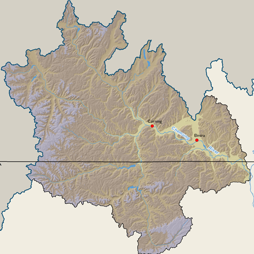
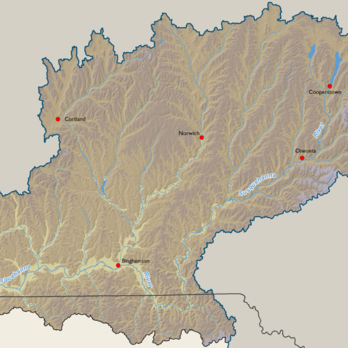
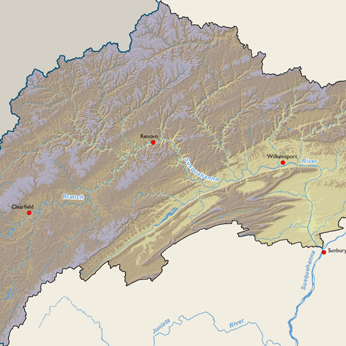
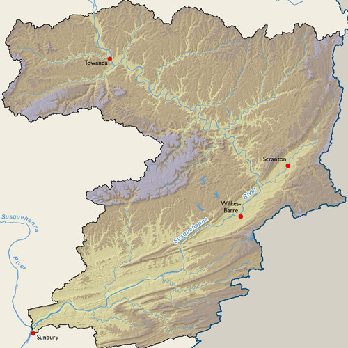
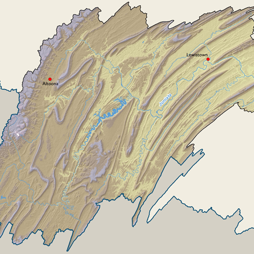
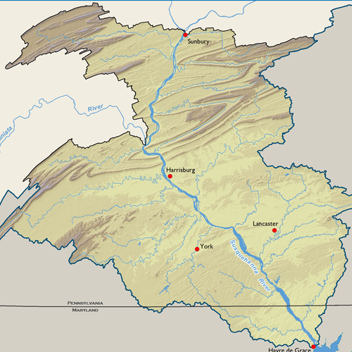
Elevation

Elevation in the Susquehanna River Basin ranges from sea level at the mouth in Havre de Grace, MD, to 3,130’ at the summit of Blue Knob in Bedford County, PA, in the southwest portion of the Basin. Elevation or topography patterns generally align with the physiographic provinces of the Basin. The southeast portion of the Basin, known as the Piedmont, and the valley extending along the Susquehanna River as far north as Williamsport and Wilkes-Barre, have relatively low rolling topography less than 1000’ and as such, include the largest concentrations of agriculture and urban development in the Basin.
The Appalachian Mountains cross the Basin diagonally from the central east to the southwest and are characterized by a valley and ridge topography. Moving north and west, elevations increase on average on the Appalachian Plateau. This is the largest region of similar topography and contains the most rural and forested portions of the Basin. Sharp contrasts in elevation exist throughout this landscape between the generally high, flat plateau and where streams have eroded steep, narrow valleys.
Subbasin Maps
Metadata
| GIS Dataset Title | National Elevation Dataset, Susquehanna River Basin |
|---|---|
| Dataset Description | The U.S. Geological Survey has developed a National Elevation Dataset (NED). The NED is a seamless mosaic of best-available elevation data. The 7.5-minute elevation data for the conterminous United States are the primary initial source data. In addition to the availability of complete 7.5-minute data, efficient processing methods were developed to filter production artifacts in the existing data, convert to the NAD83 datum, edge-match, and fill slivers of missing data at quadrangle seams. One of the effects of the NED processing steps is a much-improved base of elevation data for calculating slope and hydrologic derivatives. The specifications for the NED 1 arc second and 1/3 arc second data are: Geographic coordinate system Horizontal datum of NAD83, except for AK which is NAD27 Vertical datum of NAVD88, except for AK which is NAVD29 Z units of meters |
| Date | 1999 |
| Scale | 10 meter |
| Agency | USGS |
| Download GIS Dataset | USGS - The National Map |
| Metadata | About 3DEP Products and Services |